
The Merlot Moose Manor guidebook
Local Restaurant Recommendations
Asobi Teppanyaki
110 South Park AvenueAurum Breckenridge
209 S Ridge Stexcellent happy hour and food selection
362 Recomendado por los habitantes de la zona
Blue River Bistro
305 N Main Stexcellent happy hour and food selection
Morning fuel for the slopes or a cure to your night before
17 Recomendado por los habitantes de la zona
BreckFast
500 S Main StMorning fuel for the slopes or a cure to your night before
Giampietro Pasta & Pizzeria
100 N Main StDine in or take out
Hearthstone Restaurant
130 South Ridge StreetModis
113 S Main StAprès-ski
Breckenridge Brewery & Pub
600 S Main Stgrab a drink or buy new skis! ski tunes also coming soon.
64 Recomendado por los habitantes de la zona
Rocky Mountain Underground
114/112 S Main Stgrab a drink or buy new skis! ski tunes also coming soon.
Kenosha Breck
301 S Main StCarboy Winery Denver
400 E 7th AveThe Gold Pan Saloon
103 N Main Stattached to Carboy
Continental Divide Winery
505 S Main StWinter Hiking
This is a great, beginner level, out and back winter hike with spectacular views of town, leading to a beautiful old mining site that sits above Breckenridge. The old mining road gently climbs 1.4 miles up to a stunning view of the Sally Barber mine and Keystone in the distance. This trail is very well traveled in the winter and sees heavy use, so you can expect a packed trail during the winter months. This is a great hike for the whole family.
10 Recomendado por los habitantes de la zona
Sallie Barber Mine Trailhead
3882 French Gulch RdThis is a great, beginner level, out and back winter hike with spectacular views of town, leading to a beautiful old mining site that sits above Breckenridge. The old mining road gently climbs 1.4 miles up to a stunning view of the Sally Barber mine and Keystone in the distance. This trail is very well traveled in the winter and sees heavy use, so you can expect a packed trail during the winter months. This is a great hike for the whole family.
At the top of Ski Hill Road lies a nice and easy winter hike in Breckenridge. Peaks Trail is an incredible out-and-back hike with minimal elevation gain that weaves in and out of the beautiful lodge pole pine forest at the base of Breckenridge Ski Resort. Like many of the others, this trail sees heavy usage and stays in great shape for a nice winter stroll. Go as far as you choose, get some great views, spend some quality time in the forest, and turn around and head back whenever you want.
11 Recomendado por los habitantes de la zona
Peaks Trailhead
At the top of Ski Hill Road lies a nice and easy winter hike in Breckenridge. Peaks Trail is an incredible out-and-back hike with minimal elevation gain that weaves in and out of the beautiful lodge pole pine forest at the base of Breckenridge Ski Resort. Like many of the others, this trail sees heavy usage and stays in great shape for a nice winter stroll. Go as far as you choose, get some great views, spend some quality time in the forest, and turn around and head back whenever you want.
Summer Hiking
There are two trailheads you can use to access McCullough Gulch. The newer, lower access parking lot is located about 7 miles south of Breckenridge, on the right side of highway 9 opposite the Lodge by the Blue. From here you can access a beautiful wooded trail, turning into the old road that leads up into McCullough Gulch following the rock-strewn stream. Starting here makes the hike about twice as long.
The other access, a 1.3-mile hike, to McCullough Gulch is at the trailhead at the end of County Road 851 on Hoosier Pass. Take a right on Blue Lakes Road (CR 850), and another right on CR 851. This hike is pretty high in elevation, starting at about 11,000′, so is usually dry by July.
Local’s Tip: Wildlife sightings are common on high alpine hikes. Help us care for Colorado and keep wildlife wild by following these tips.
38 Recomendado por los habitantes de la zona
McCullough Gulch Trailhead
4192 CO-9There are two trailheads you can use to access McCullough Gulch. The newer, lower access parking lot is located about 7 miles south of Breckenridge, on the right side of highway 9 opposite the Lodge by the Blue. From here you can access a beautiful wooded trail, turning into the old road that leads up into McCullough Gulch following the rock-strewn stream. Starting here makes the hike about twice as long.
The other access, a 1.3-mile hike, to McCullough Gulch is at the trailhead at the end of County Road 851 on Hoosier Pass. Take a right on Blue Lakes Road (CR 850), and another right on CR 851. This hike is pretty high in elevation, starting at about 11,000′, so is usually dry by July.
Local’s Tip: Wildlife sightings are common on high alpine hikes. Help us care for Colorado and keep wildlife wild by following these tips.
From Blue Lakes Road (CR850), continue straight instead of turning right into McCullough Gulch, and access Monte Cristo Creek. Upper Blue Lake is a reservoir water source for Aurora and Colorado Springs, and the gulch is spectacular. There’s more hiking above the upper lake too.
Keep your eye out for a small waterfall visible from the road as you drive up through Monte Cristo Gulch. You can explore the Granite cliffs and take in the wildflower meadows between the lakes after parking in the lot below the dam.
14 Recomendado por los habitantes de la zona
Blue Lakes Trailhead
Blue Lakes RoadFrom Blue Lakes Road (CR850), continue straight instead of turning right into McCullough Gulch, and access Monte Cristo Creek. Upper Blue Lake is a reservoir water source for Aurora and Colorado Springs, and the gulch is spectacular. There’s more hiking above the upper lake too.
Keep your eye out for a small waterfall visible from the road as you drive up through Monte Cristo Gulch. You can explore the Granite cliffs and take in the wildflower meadows between the lakes after parking in the lot below the dam.
An easy hike is generally suitable for anyone who enjoys walking. The trail will be mostly level or with a slight incline. Generally less than 3 miles. Easy hikes are great for when you have a short amount of time to hike, have kids or non-hikers with you, want to relax in nature. Want more summer hiking ideas?
Iowa Hill Trailhead
An easy hike is generally suitable for anyone who enjoys walking. The trail will be mostly level or with a slight incline. Generally less than 3 miles. Easy hikes are great for when you have a short amount of time to hike, have kids or non-hikers with you, want to relax in nature. Want more summer hiking ideas?
Hike the Burro Trail as an out-and-back route for as long (or as short) as desired. Just five or 10 minutes out can make you feel like you’re miles away. The Burro trail provides access to a vast network of backcountry hiking options and is a great option for those staying at the many properties along Village Road.
Getting there: The Burro trail can be accessed from the bottom of the Lehman ski trail, located at the base of Peak 9 off Village Road in Breckenridge. You can walk or bike from downtown, but the trail is also accessible via the Breckenridge Free Ride’s yellow route.
Burro Trail
Burro TrailHike the Burro Trail as an out-and-back route for as long (or as short) as desired. Just five or 10 minutes out can make you feel like you’re miles away. The Burro trail provides access to a vast network of backcountry hiking options and is a great option for those staying at the many properties along Village Road.
Getting there: The Burro trail can be accessed from the bottom of the Lehman ski trail, located at the base of Peak 9 off Village Road in Breckenridge. You can walk or bike from downtown, but the trail is also accessible via the Breckenridge Free Ride’s yellow route.
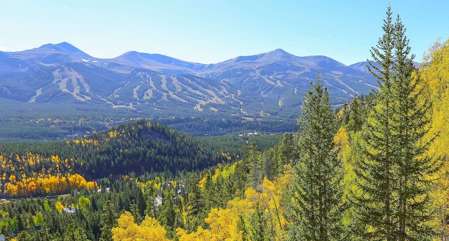
BOREAS PASS ROAD IS ONE OF THE BEST PLACES TO VIEW THE FALL COLORS.
From the end of pavement to the summit of Boreas Pass is about 6.5 miles of dirt road, passable by most vehicles except in muddy, wet or winter conditions. Park at the trailhead and walk or bike as far as you’d like, taking in views of the Tenmile mountain range and Breckenridge Resort. If you have a 4WD car, keep driving through the aspens to the top of the continental divide. The historic Section House at the top of the pass is a ski hut in the winter, available for overnight reservations. If you have extra time, check out Baker’s Tank trail or Aspen Alley in the fall for prime leaf peeping and great mountain biking.
Getting there: At the very south end of Breckenridge, take Boreas Pass Road all the way to the top. About 4 miles from town, the pavement ends at the Boreas Pass Trailhead. Park here to walk or bike along the road or continue driving to the top of the continental divide.
8 Recomendado por los habitantes de la zona
Boreas Pass Road
Boreas Pass RoadBOREAS PASS ROAD IS ONE OF THE BEST PLACES TO VIEW THE FALL COLORS.
From the end of pavement to the summit of Boreas Pass is about 6.5 miles of dirt road, passable by most vehicles except in muddy, wet or winter conditions. Park at the trailhead and walk or bike as far as you’d like, taking in views of the Tenmile mountain range and Breckenridge Resort. If you have a 4WD car, keep driving through the aspens to the top of the continental divide. The historic Section House at the top of the pass is a ski hut in the winter, available for overnight reservations. If you have extra time, check out Baker’s Tank trail or Aspen Alley in the fall for prime leaf peeping and great mountain biking.
Getting there: At the very south end of Breckenridge, take Boreas Pass Road all the way to the top. About 4 miles from town, the pavement ends at the Boreas Pass Trailhead. Park here to walk or bike along the road or continue driving to the top of the continental divide.
Aspen Alley to Ice Rink Parking Lot is a 2.4 mile moderately trafficked point-to-point trail located near Breckenridge, Colorado that features beautiful wild flowers and is good for all skill levels. The trail offers a number of activity options and is best used from May until September
20 Recomendado por los habitantes de la zona
Ice Rink Lot
189 Boreas Pass RdAspen Alley to Ice Rink Parking Lot is a 2.4 mile moderately trafficked point-to-point trail located near Breckenridge, Colorado that features beautiful wild flowers and is good for all skill levels. The trail offers a number of activity options and is best used from May until September